
Trace Barnstable Streets
For a named Barnstable street, begin with the exact number and the Town assessor’s street search. It returns a parcel, location, owner field, Details link, and Map link. That result is a strong place to anchor an address trail because the parcel identifier persists more reliably than a mailing label. The field does not establish who occupies the site. It identifies the assessed property record and gives an owner date that should travel with any notes.
Then move from parcel context to title and local-list boundaries. The map can confirm which lot is meant when roads, water, or town land interrupt the visible street. The Registry can identify recorded instruments tied to parties and parcels. A municipal voter-list request is a separate election-office route, and a voter address is still a registration address rather than proof of continuous presence.
- Enter the street number and street name in the Town assessor search. Record the parcel or map-block-lot key, the village, and the owner-as-of date shown on the detail record.
- Open the linked Town GIS parcel map. Check the parcel outline, street placement, roads, water, zoning, and surrounding lots before treating similarly named addresses as the same place.
- Use the assessed owner name in the Registry name search. Limit the town to Barnstable when the question concerns the Town of Barnstable, not all fifteen county towns.
- Read the deed image and record the parties, instrument type, recording date, book/page or instrument number, and any plan reference. Work backward through the recorded chain rather than relying on an address hit.
- For a documented historical question, ask the Town Clerk about a municipal voter list or local street-list material by municipality, ward or precinct, year, and format. Use historical directory and newspaper holdings only as dated household evidence.
Note: A street result gains value when each item keeps its own source date, custodian, and record type.
Barnstable Street Address Fields
Bare street text is often too loose for Barnstable address research. The same municipal town can use Barnstable Village, Hyannis, Centerville, Cotuit, West Barnstable, or another community name in different systems. Postal city and ZIP are delivery fields. They are not replacements for the Town of Barnstable or the parcel key. Keep each part separate before searching by address, especially where an old deed, an assessor result, and a modern mailing address use different labels.
- Parcel
- A defined unit of land in the assessor and GIS system, usually identified by a map, block, lot, or parcel code.
- Situs address
- The physical address of the property. It can differ from the mailing address shown for the assessed owner.
- Plat or plan
- A recorded drawing that can show a subdivision, boundary, or easement. Barnstable Registry plan records can be more useful than a loose street label.
- Criss-cross directory
- A historical directory arranged by address rather than alphabetically by name. Its entries are dated snapshots, not current occupancy proof.
Normalize street number, directional, street name, suffix, unit, village or community, postal city, ZIP, municipal town, and parcel map-block-lot. The research record specifically warns against flattening Hyannis, Hyannis Port, West Hyannis Port, and West Barnstable into one place. A street search that preserves those fields is less likely to blend nearby but distinct records.
Barnstable Street Property Search
The Town of Barnstable Assessing Property Look-Up has three useful entry routes: Map/Block/Lot, owner last name, and street number plus street name. Full or partial entries are accepted. A street response is paginated in batches of 40, so a long corridor may require moving through several result pages. Use the result columns to move from a street line to the Details or Map record, rather than copying a name from a broad list.
| Assessor field | Input or result | How it helps the street trail |
|---|---|---|
| Map/Block/Lot | Text search | Connects an address to the parcel and GIS record. |
| Owner last name | Full or partial surname | Provides a lead for Registry name research, with common-name care. |
| Street number and name | Separate fields | Lists matching locations and may require several 40-result pages. |
| Details | Result link | Shows owner-as-of, village, values, sales history, and related property fields. |
| Map | Result link | Opens parcel context for roads, nearby lots, and physical features. |
A Town assessor detail record shows the kind of property fields available, including parcel, location, owner, assessed values, sales, zoning, and map links.
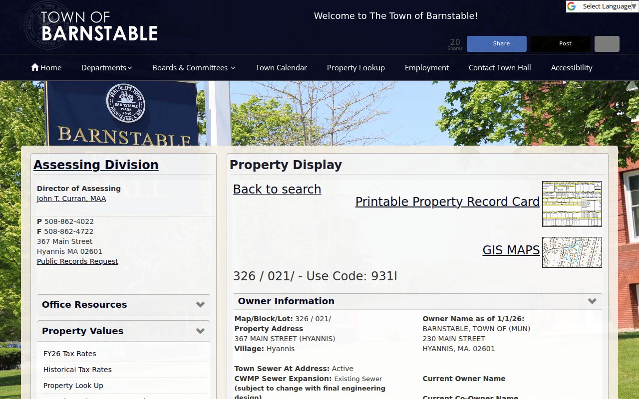
The public-office sample is useful for reading field labels, not for drawing conclusions about a private household. Assessment is not a title opinion, and a sale price is not a measure of anyone’s wealth.
Barnstable Street Map Context
The Town GIS Property Maps add the physical setting that a list of street results lacks. The viewer supports address, street-name and house-number selection, parcel lookup, and map clicking. Its documented layers include parcels, buildings, villages, zoning, historic areas, wetlands, flood zones, roads, town land, and other overlays. Those layers help distinguish an adjacent parcel from one separated by a road right-of-way, water, or municipal land.
A Town GIS REST map-service listing displays the available map layers used for local property context.
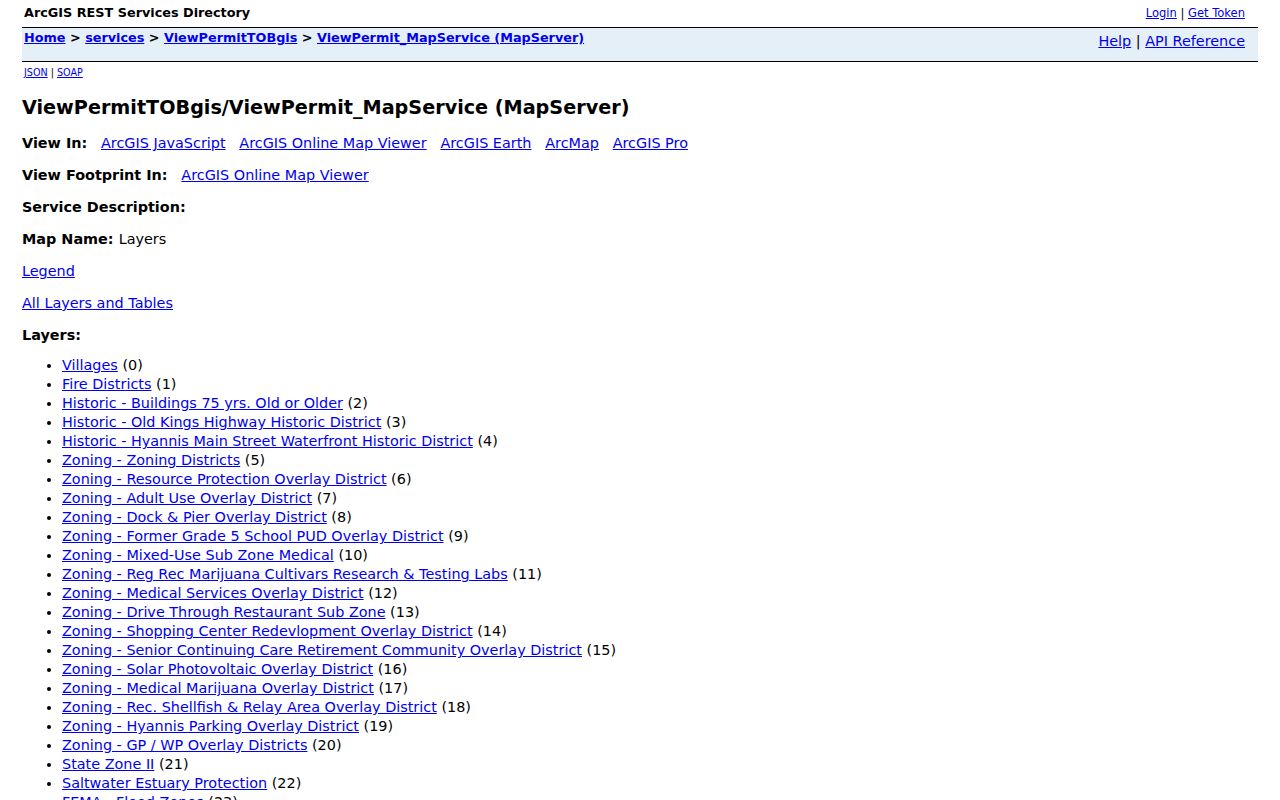
Map geometry can confirm a parcel setting, but it cannot verify a household, a social relationship, or an automated radius list. The inspected research did not capture a verified public tool for neighbors within a chosen distance or a complete abutter list.
The MassGIS property-tax parcel page was updated July 22, 2026 as part of statewide standardized parcel work. That is a data-infrastructure update, not a resident list, and a current parcel vintage should be checked before relying on statewide context.
Note: Use the GIS parcel ID to check location context, then return to the source record for ownership or title facts.
Barnstable Street Deed Names
Once an address produces an assessed owner or a prior sale reference, the Barnstable County Registry name search is the main title route. It accepts last name or corporation, first name, party role, document type, town, index range, and date range. Search grantor and grantee roles separately when retracing a transaction. The county Registry covers fifteen towns, so select Barnstable for town-level work and label countywide results clearly.
The Registry holds deeds, mortgages, discharges, assignments, liens, easements, restrictions, plans, and related instruments. A grantee on a recorded deed may be an owner in that transaction, but the document does not prove that person now lives there. Open the image and record the instrument details before using it as a link in an address trail.
The Registry name-search form shows the party-role controls, town and document filters, date range, and index-range options.
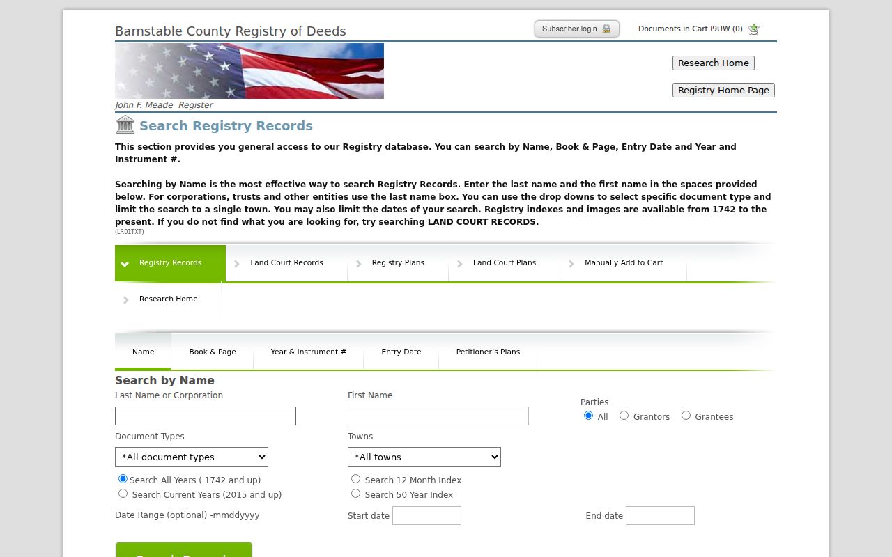
Name variants matter. An earlier surname, trust, corporation, or first initial can be a valid title-search lead, but each result needs confirmation by town, recording date, document type, and parcel or plan context.
Barnstable Street Address Index
The Registry also offers an address route with Property Address, document type, town, and optional dates. It can help find newer references, but it is not the foundation for an older Barnstable address trail. The official warning says address indexing begins in August 1993, the address is entered by the recording party, and the field is not verified for completeness. A blank response can therefore mean the address was not indexed, not that no instrument exists.
The Registry address-search form displays the Property Address, document, town, and date controls with that limitation.
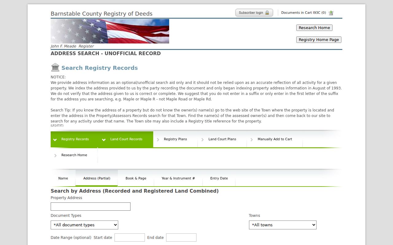
Try a broader street-name form or remove a suffix only as a recall step. Validate any hit through the relevant parties, recording date, book/page or instrument number, and the assessor or GIS parcel. For a quicker deed-only route, Find My Deed is narrower and can return same-name matches.
Barnstable Records by Street
Address-keyed sources answer different questions, so the strongest Barnstable street-based research keeps their limits visible. The assessor is the full inspection point for current municipal property fields. GIS gives map context. The Registry provides title instruments. The Town Clerk is the route for a public municipal voter-list request, while the state’s individual status screen is not an open statewide names database. Historical library material can date a household reference, but it needs its own repository and date.
| Address-keyed source | Custodian | What it can establish | Access route |
|---|---|---|---|
| Property detail | Town Assessing | Parcel, location, village, owner-as-of, values, sales, map link | Public property portal |
| Parcel map | Town GIS | Parcel geometry, roads, buildings, zoning, and environmental layers | Public map viewer |
| Title instruments | Barnstable County Registry of Deeds | Recorded parties, deed history, plans, and document references | Free index and image view; clean prints are paid |
| Municipal voter list | Town Clerk or election office | Requestable election-list fields, subject to public and protected-field rules | Specify municipality, ward or precinct, year, and format |
| Historical household material | Sturgis Library and State Library collections | Dated newspaper, directory, or census evidence | Repository and collection-specific access |
For current voter status, the Massachusetts individual status lookup requires first name, last name, date of birth, and a five-digit residential ZIP. It is not a street-by-street table. Public voter-list material has different access rules, including protected telephone, email, veteran, absentee, confidential, and minor fields. A narrow request to the Town Clerk is the documented local path.
Barnstable Street Records Time Depth
Three Registry dates explain why a modern address search cannot answer every street-history question. Barnstable County Registry real-property records begin in 1742. Land Court records begin in 1898. The newer address index begins only in August 1993 and remains unofficial and incomplete. For an old parcel, a name, book/page, instrument, plan, or Land Court reference is more dependable than expecting a street label to persist.
Public Registry index and image viewing is free. The image display carries a notice that it is not an official copy. A clean print goes through the print cart or account and costs $1 per page plus the card convenience charge stated by the Registry. That distinction matters when a reader needs a working research image versus a paid clean copy. The Registry public-access information describes those access conditions.
Note: Record the date band before searching, because modern address assistance and early title research use different keys.
Barnstable Street Village Checks
Barnstable address research needs a municipal-town check before a title search. Barnstable Village, Centerville, Cotuit, Hyannis, Marstons Mills, Osterville, and West Barnstable are core town villages, while other delivery communities also appear in postal use. ZIP 02635 is shared by Cotuit and Santuit. Massachusetts address standards also use municipal town, postal city, and community name as separate fields.
A parcel may carry a village label that differs from the postal address. The official material notes Captain Jacs Road as an example of overlapping West Barnstable and Centerville community labels. Save the source spelling and ZIP as returned, then retain Town of Barnstable as the municipal field. This avoids joining records merely because they share a postal label or a common street name.
Barnstable Street Search Limits
A Barnstable street search can connect public property, title, map, and dated local-record trails. It cannot produce a verified list of everyone who lives on a road. Assessor ownership is not residency. Registry title is not occupancy. An address result from USPS does not confirm a person or company at a location, and adjacent GIS parcels do not establish a relationship between households. Treat records as separate, dated statements and do not merge similar names without an independent identifier.
Lawful use. Use Barnstable street records for personal, historical, property, or civic research. Massachusetts law addresses stalking and criminal harassment in MGL c.265 §§43 and 43A, so do not use these records to monitor, contact, intimidate, or harass a living person.
For a correction or a record not shown online, contact the custodian that created it. Registry public-record guidance directs requests to the Registry’s Records Access Officer, while a municipal request should state the record type, date range, department, and preferred format. The Massachusetts Public Records Law, MGL c.66 §10 with exemptions in MGL c.4 §7, does not make every field available for republication.